INVISIP
Information Visualisation for Site Planning

Members
Reiterer, Limbach, Müller, Klein, Grün, König, Rexhausen, Obermüller, Liebrenz, Gerken, Memmel, Gundelsweiler, Jetter
Description
The project INVISIP is part of the EU Information Society Technologies Programme and facilitates processes and parties of location site planning. Site planning should be a combined effort of planning and coordination. To do so, Geodata is needed, which is commonly available in great quantity. What is not yet available is a common Metadata standard for geographical of georeferenced data, thus making it difficult to facilitate or engage the exchange of geometadata. Planners (technicians, local authorities) must rely on a meaningful database.
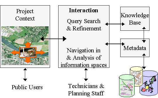
INVISIP will provide a technical platform for the exchange and acquisition of metadata, furthermore it will help visualising the complex planning and decision making process of location site planning.
The working group Information Systems will work on the packages 'Development of a Metadata Browser' and 'Evaluation'. The metadata browser will use cutting edge technologies to visualize search and query refinement and result visualizations. Besides the software-ergonomic requirements will be tested, advanced and integrated into the software package. A substantial and extensive feasibility testing conducted by the working group Information Systems will be the project's culmination.

External Page
To view this content (source: www.xyz.de ), please click on Accept. We would like to point out that by accepting this iframe, data could be transmitted to third parties or cookies may be stored.
You can find more information on our privacy policy .
Publication list
